A simple python application that creates cartographics maps in real time that uses python 3, wxPython 4 (Phoenix) and pyOpenGL 3.1.
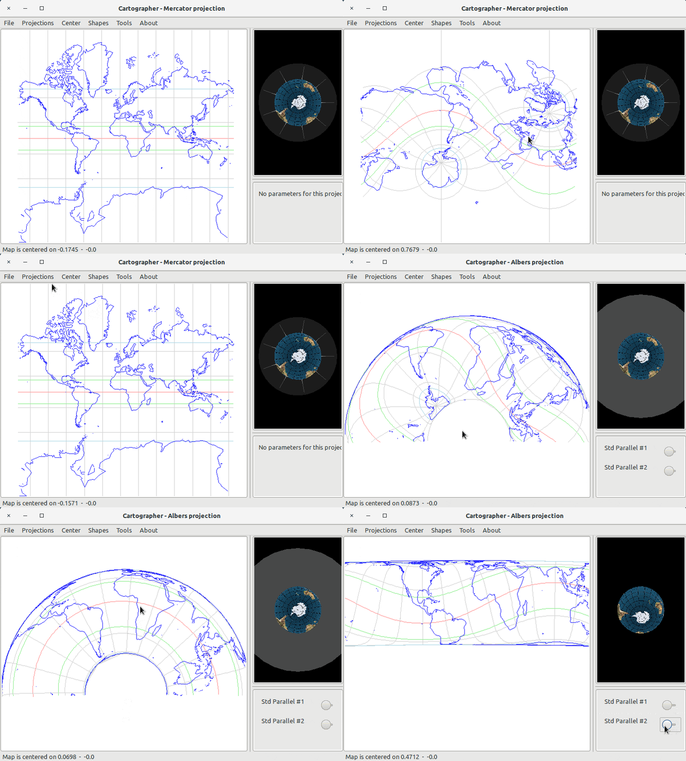
Here's a screenshot of the application:
Install the dependencies:
pip install -r requirements.txt
Launch it with:
python3 cartographer.py
If you prefer using Docker, you can build the container using the Dockerfile present in the root directory:
sudo docker build -t cartographer .
then, to export its display to the host, you need to set some env variables:
XSOCK=/tmp/.X11-unix
XAUTH=/tmp/.docker.xauth
xauth nlist :0 | sed -e 's/^..../ffff/' | xauth -f $XAUTH nmerge -
and then launch it:
docker run -ti -v $XSOCK:$XSOCK -v $XAUTH:$XAUTH -e XAUTHORITY=$XAUTH cartographer
The main window is formed by three panels:
- the projection panel, where you can set the alignment and the center of the projection by clicking on the projection panel and moving it
- the earth panel, where you can see how the projection is made, since it shows an earth and the projection solid where the coordinates are projected (work in progress)
- the configuration panel, where you can set the parameters of the projection if it has any
You can change the projection using the Projections menu, and you can choose the resolution of the map from the Maps menu (Low Resolution is the 1/110M scale shape, High Resolution the 1/10M one). File > Export projection as Image saves the current map as a PNG or JPEG. The shapes are the public domain shapefiles provided by Natural Earth website.